Part 1 Cambridge to Bedford is here
Part 3 Milton/Keynes/Bletchley to Oxford is here
In a previous post, I covered the first part of my three part cycle ride from Cambridge to Oxford, namely Cambridge to Bedford. This post covers the next stage, from Bedford to Bletchley. I am basing the route on Route 51 of the National Cycle Network (NCN51). The GPS track of my ride is below, in orange: the map also shows Part1 and Part 3.
I parked at Bletchley rail station, then took the train to Bedford. Before doing so, however, I took the opportunity to pay an all too short visit to the Bletchley Park museum commemorating the work of Alan Turing and his fellow WW2 code (or cypher?) breakers: well worth a longer visit.
Bletchley-Bedford is a funny little railway line that somehow escaped the Beeching axe, and uses single railcar trains, with dedicated space for two cycles. Had it been axed, it would doubtless now be a cycle route! If the proposed East-West Rail project goes ahead, the line would be incorporated and reinvigorated as part of the route linking Oxford and Cambridge.
I alighted at the stop before Bedford main station, ie Bedford St Johns, and cycled to join NCN51 on the North side of the bridge over the River Great Ouse. I actually deviated from the official NCN route somewhat by staying on the path beside the north bank of the river down to Kempston, rather than crossing sooner and negotiating what looked like some busy roads. The path was fine, except the final 100 metres or so which is a footpath with a stepped bridge and a wicket gate, which you have to negotiate before arriving on the South bank of the river at Mill Lane.
Once out of the suburbs of Bedford, NCN51 meandered pleasantly enough. I particularly liked the Marston Vale Millenium Country Park (not least because it has a cafe in the Visitor centre).
I also liked the segment between the crossing of the A421 at Marston Moritaine and the village of Salford, which follows some nice cross-country bridleways. Curiously, the route here was well signed with official NCN signs, except at key junctions, so having the route on my GPS helped. The official NCN mapping on the Sustrans website shows an alternative loop north through Cranfield, and maybe they are trying to discourage use of the southern part.
Back on road, the route through Salford was busy with fast traffic, but when I turned off to Wavendon, it was much quieter due to the fact that the road was closed to through traffic for building works: I managed to squeeze past the road block. From the outskirts of Milton Keynes I could have followed a more direct line back to Bletchley station on cycle paths beside busy roads, but I chose to eek it out by continuing through the suburbs on the NCN51 to the Open University, then picking up the Ouzel valley path and Grand Union Towpath, all on good, quiet, cycle paths: I was impressed by the cycling provision in MK. (For more about the Grand Union towpath hereabouts, see my blog post of 20 June 2015.)
You could shorten the route by cutting out some of the meanders of the NCN51, but it would be a less pleasant ride on busier roads. And it was only a relatively short 27 miles, easily covered in a lazy summer's afternoon.
Part 3 Milton/Keynes/Bletchley to Oxford is here
In a previous post, I covered the first part of my three part cycle ride from Cambridge to Oxford, namely Cambridge to Bedford. This post covers the next stage, from Bedford to Bletchley. I am basing the route on Route 51 of the National Cycle Network (NCN51). The GPS track of my ride is below, in orange: the map also shows Part1 and Part 3.
I parked at Bletchley rail station, then took the train to Bedford. Before doing so, however, I took the opportunity to pay an all too short visit to the Bletchley Park museum commemorating the work of Alan Turing and his fellow WW2 code (or cypher?) breakers: well worth a longer visit.
 |
| Bletchley Park |
Bletchley-Bedford is a funny little railway line that somehow escaped the Beeching axe, and uses single railcar trains, with dedicated space for two cycles. Had it been axed, it would doubtless now be a cycle route! If the proposed East-West Rail project goes ahead, the line would be incorporated and reinvigorated as part of the route linking Oxford and Cambridge.
I alighted at the stop before Bedford main station, ie Bedford St Johns, and cycled to join NCN51 on the North side of the bridge over the River Great Ouse. I actually deviated from the official NCN route somewhat by staying on the path beside the north bank of the river down to Kempston, rather than crossing sooner and negotiating what looked like some busy roads. The path was fine, except the final 100 metres or so which is a footpath with a stepped bridge and a wicket gate, which you have to negotiate before arriving on the South bank of the river at Mill Lane.
 |
| Low bridge, Great Ouse towpath |
 |
| Great Ouse |
 |
| Cycle Path out of Bedford |
 |
| You need to carry over this footbridge |
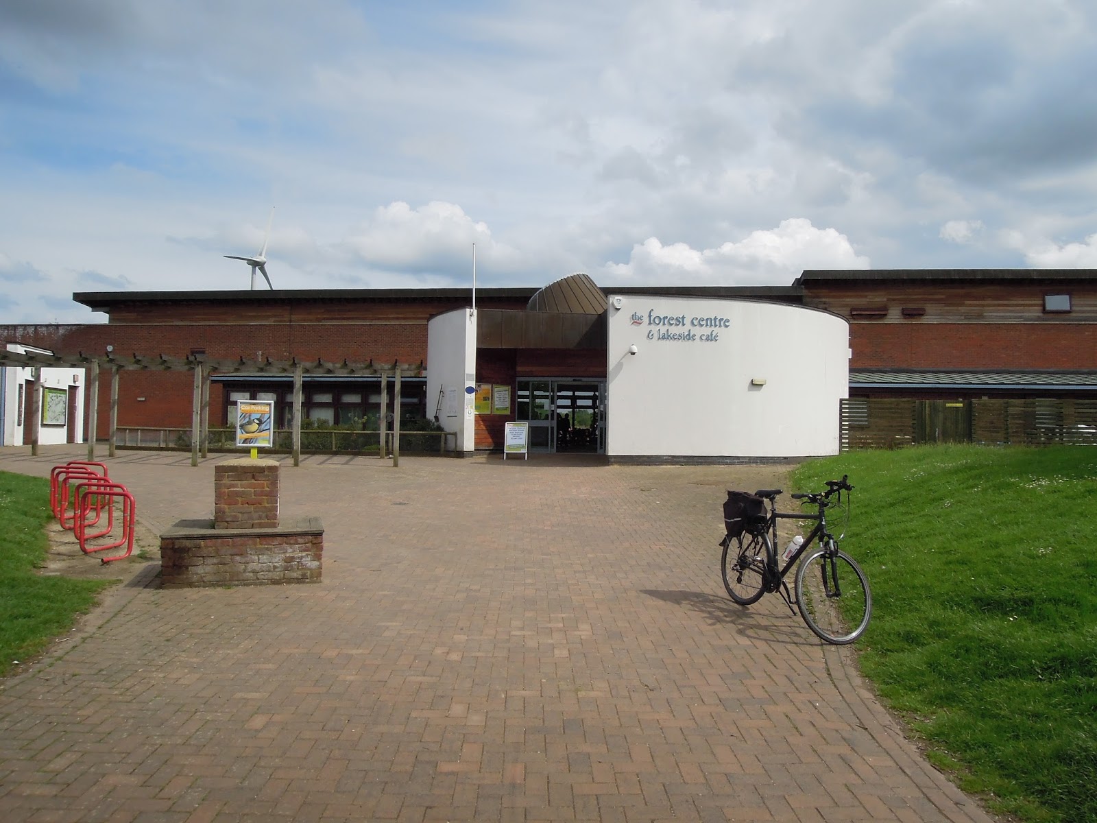
Once out of the suburbs of Bedford, NCN51 meandered pleasantly enough. I particularly liked the Marston Vale Millenium Country Park (not least because it has a cafe in the Visitor centre).
 |
| Marston Vale Millenium Country Park |
 |
| Country Park visitor centre and cafe |
 |
| Church of St Mary at Marston Moretaine, with its unusual detached tower |
 |
| A421 crossing |
I also liked the segment between the crossing of the A421 at Marston Moritaine and the village of Salford, which follows some nice cross-country bridleways. Curiously, the route here was well signed with official NCN signs, except at key junctions, so having the route on my GPS helped. The official NCN mapping on the Sustrans website shows an alternative loop north through Cranfield, and maybe they are trying to discourage use of the southern part.
 |
| Typical NCN signing |
 |
| Typical bridleway on the way to Salford |
 |
| Looking back |
 |
| Reynolds Wood (Woodland Trust) |
Back on road, the route through Salford was busy with fast traffic, but when I turned off to Wavendon, it was much quieter due to the fact that the road was closed to through traffic for building works: I managed to squeeze past the road block. From the outskirts of Milton Keynes I could have followed a more direct line back to Bletchley station on cycle paths beside busy roads, but I chose to eek it out by continuing through the suburbs on the NCN51 to the Open University, then picking up the Ouzel valley path and Grand Union Towpath, all on good, quiet, cycle paths: I was impressed by the cycling provision in MK. (For more about the Grand Union towpath hereabouts, see my blog post of 20 June 2015.)
 |
| Wavendon Arms pit stop |
 |
| Typical cycle path Milton Keynes |
 |
| Open University |
 |
| Ouzel cycle path (Milton Keynes) |
 |
| Fenny Stratford Lock on the Grand Union Canal |
You could shorten the route by cutting out some of the meanders of the NCN51, but it would be a less pleasant ride on busier roads. And it was only a relatively short 27 miles, easily covered in a lazy summer's afternoon.
Comments
Post a Comment