Summary
The Downs Link provides a near-continuous off road cycle route following two disused railway lines (Guildford to Christ's Hospital, and Christ's Hospital to Shoreham), linking (as its name suggests) the North and South Downs, passing through pleasant countryside and emerging through the Shoreham Gap to reach the sea at Shoreham. Officially the Downs Link starts on St Martha's Hill, but, as described in this post, the route from there to Bramley is hilly and either stony or sandy, so most people starting from Guildford will follow either NCN22 or the Wey Navigation towpath to reach the disused railway path near Shalford.
Travel: Guildford is on the main line from Waterloo. Having arrived at Shoreham you can either turn round and cycle back, or take the train from Shoreham (to return to Guildford, change at Havant). Alternatively, you can pick up the NCN2 along the coast, for example East to Brighton (trains back to Guildford via Gatwick Airport) or West to Worthing (trains via Havant). Check rail websites for latest timetable info and bike carriage conditions. Bikes are usually allowed outside rush hours.
Map: I describe the route assuming starting at Guildford train station, and finishing with a ride along NCN2 to Brighton.
GPX: You can download the Google map info, as a KML/KMZ file, then convert to GPX using a site like GPS Visualiser, or get the route with options from the cycle.travel website here. You download and use any such data entirely at your own risk.
Distance: Guildford to Shoreham: 37 miles; it's a further 7 miles to Brighton, 44 miles in total
Surface: The Downs Link surface is mainly dirt and compacted stone/gravel so don't expect smooth tarmac, and there will be mud and puddles after rain and in winter. A mountain or hybrid bike will be best.
Directions (see map):
From Guildford train station, walk under the subway to the far side of Bridge Street and follow the pedestrian way around the gyratory to emerge beside the River Wey. Cycle under the A322 bridge, through a car park, past the Town Bridge, and on down Millmead then walk over a footbridge over the Wey and take the towpath past Millmead Lock. (NB the towpath at Millmead Lock is (2023) blocked by a weir collapse, with no sign that it will be repaired any time soon. See map for short diversion shown in Orange.) You then have two main options (see map):
- using National Cycle Route NCN22 (a reasonable track): shortly cut across to a footbridge over the Navigation beside Guildford Rowing Club. This bridge has a cycle 'gutter' to assist pushing your bike up the steps, but it is steep, so take care. On the other side, cycle along a short stretch of shared use pavement beside the busy A281, and into Shalford Park. Now follow the cycle route signed as NCN22 across Shalford Park and on through woods, passing the Thames Water depot. After here the track becomes a bit stony, and there is a short flight of steps, then a well-surfaced track (Dagley Lane) crossing over the Guildford-Shalford railway line on a bridge. Carry straight on past cottages and over a little green to reach the A248 at Broadford. Turn right (CARE) and cross the road bridge over the Wey, then bear right (CARE) onto the pavement on the right hand side of the road which acts as a cycle path. This soon peels off and descends to a track. Turn left under the A248 and then take the track signed straight on as the Downs Link. This is a good surface which crosses back over the Wey on a specially constructed bridge and continues to the A281.
- Wey Towpath (pleasant but bumpy and muddy, and quite busy with walkers etc): simply follow the towpath, passing (with CARE) the golden sands at Ferry Lane, St Catherines Lock, under the railway line, cross the A248, reach the specially constructed bridge over the river, and use it to cross over. You are now on the Downs Link. Cycle down to the A281.
Cross the (busy) A281(CARE). From here you follow the trackbed path. Places to watch out are:- At Cranleigh, the track skirts the southern edge of town and passes the leisure centre.
- Just past Baynards Station, cross a lane and continue for a further short stretch of track and under a bridge carrying Cox Green Lane. Be careful here: follow the Downs Link signs carefully, it can be disorienting: emerge onto the lane, cross over the bridge then go left on a track through the woods (take CARE descending). This diversion is necessary to take you over the old railway tunnel.
- South of Rudgwick cross the A281: take great CARE, in July 2020, a cyclist was killed crossing here.
- After passing Slinfold, and going under the A264, the final stretch of trackbed which joined to the main line at Christ's Hospital station has (June 2020) been resurfaced, passing through a tunnel under the railway line, then angling South West to branch off outside the entrance of Christ's Hospital School to follow a track beside the railway line. (If this route is closed, you can follow the old on-road diversion - see map.)
- At Southwater, you emerge under a bridge to a set of traffic lights. Diagonally across to your left is a village surgery: pass round the left hand side of this passing some 'penny farthing' metal sculptures to pick up the track again.
- At the B2135 at Partridge Green, turn right along the road then, after a few hundred yards, turn left on a track past Homelands Farm, to rejoin the disused railway.
- At Henfield, turn left then right down Station Road and at the bottom of the hill, where the road turns sharp left, take the road to the right and immediately take the track signed to the left
- After crossing over the River Adur, the trackbed path ends, and a rough track (CARE) takes you past Wykham Farm and runs into Kings Barn Lane, then follow Kings Stone Avenue and Castle Lane to a roundabout with the A283.
- Take the cycle track down the left hand side to the A283, then cross over (CARE) to rejoin the trackbed path, which meets with the South Downs Way and crosses a bridge over the Adur. .
- Continue on the trackbed path under the A27, past the Old Toll Bridge and under the railway bridge, and past a riverside housing development to pitch out at the roundabout where the A283 meets the A259.
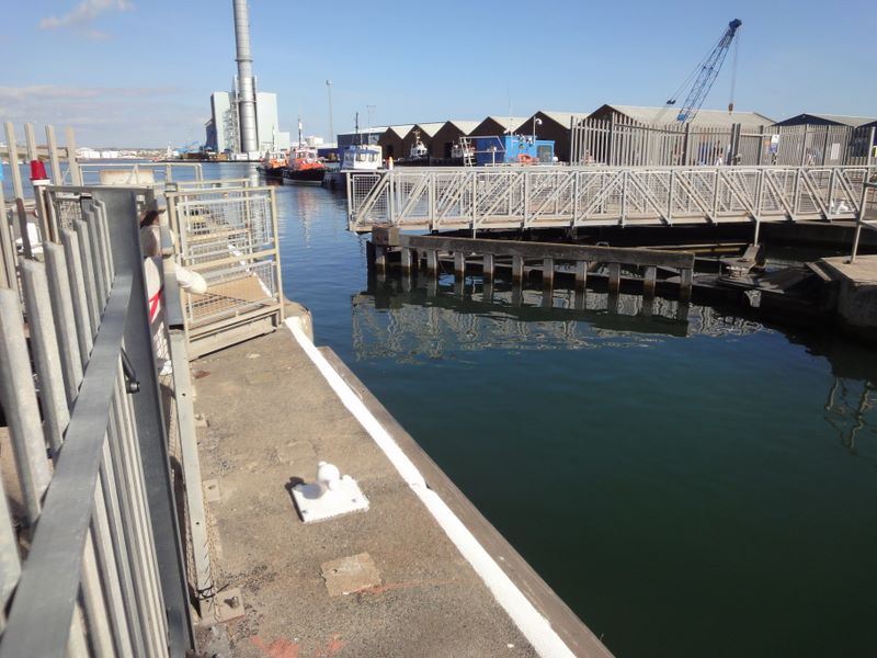
You have now reached Shoreham. To continue to Brighton, follow the reasonably well signed NCN2 starting through the quieter backroads around Shoreham, then on to the footbridge over the lock gates at the entrance to Shoreham Harbour (you will have to walk over the gates). On the other side of the harbour you emerge onto Basin Road South, which eventually takes you onto the sea front cycle path through Hove and Brighton. Now it's a pretty straightforward ride along the seafront, until you see the station signed left up West Street. This is a busy street, so take care as you cycle up to catch your train home (or make your way to The Lanes for a bite to eat beforehand).
You could also go West along the coastal cycle route to Worthing, which is best started by crossing the cycle/pedestrian bridge over the Adur opposite East Street, Shoreham.
Refreshments: You pass through or near many towns and villages along the way, so there are many options. These businesses come and go, but one might try the cafe at Southwater Country Park, the Old Railway pub on the route at Henfield, and Carats Cafe, tucked beside the sea wall just after you emerge onto Basin Road South at Shoreham.
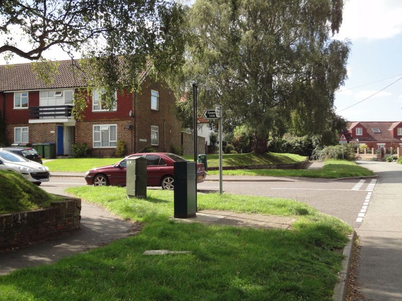
Finding your way: As with any ambitious cycle ride in the UK, it's best to download the route and follow it on a GPS or smartphone app. The route is not well signed in Guildford town centre, but the Wey towpath is pretty obvious, and NCN22 is reasonably well signed. The Downs Link is reasonably well signed with a 'double bridge' logo, but it's easy to get confused at the locations mentioned above. The Downs Link is technically NCN223, but is rarely signed as such. NCN22 uses the Downs Link to just south of Bramley, where it branches off towards Dorking: be careful not to follow those signs.
Photos
 |
Lens at Shoreham
|


Should read West Grinstead in photos not East Grinstead
ReplyDelete