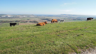
The South Downs Way is a challenging and lofty ride over grassy chalk downland, offering fine views over the Hampshire and Sussex Countryside, and out to sea. Today, yet another glorious autumn day, I decided to try and incorporate a shorter stretch of the Way as part of a circular ride, namely the path along the Downs above the valley of the River Ouse, running down from Lewes to Newhaven. A map of my GPS track is here in red (the blue track is a shorter variant I did the following week).
I parked in Stanmer Park adjacent to the campus of the University of Sussex, being careful to use one of the clearly designated (free) car parks - park anywhere else and you risk a ticket. I grabbed a coffee at the tea room in Stanmer village, then set off along the cycle path beside the busy A27. I soon joined the South Downs Way at the bridge which carries it over the road, and then followed the blue acorn signs, climbing to reach and follow the ridge of the Downs, traversing Juggs Road, Swanborough Hill, Ifford Hill, Front Hill and Mill Hill. This is one of the finest sections of the Way for cycling, over firm grassland, chalk tracks (a bit rough) and a concrete road, with vistas over Lewes, Mount Caburn, Itford Hill, and latterly the Ouse Valley stretching down to Newhaven and the sea.
Knowing the official descent to the valley floor is very steep and rough, I departed from the Way and descended steep tarmacked Mill Lane to the little village of Rodmell. Here I made a short diversion to see Monks House, Virginia Woolf's house, now in the care of the National Trust but not open when I visited. I returned to the road and went down to the Ouse at Southease, where I picked up the Egret's Way beside the river, which has been excellently surfaced as a cycleway. This runs out at Piddinghoe, but I went on along the riverside path to reach Newhaven.
I navigated the busy centre of the town with some difficulty and finally emerged onto National Cycle Network Route 2, which takes a very stony track over to Peacehaven. It was then an enjoyable run along the grassy clifftop in front of the bungaloid development to Saltdean, where I picked up the undercliff path along the wide concrete sea wall to Rottingdean. A stiff ascent of the bridleways over the Downs behind Rottingdean brought me to the summit of the Falmer Road, B2123, behind Woodingdean (lots of 'deans' round here). Fortunately, a reasonable grit cycle path has been laid beside this busy road, and this provided a safe downhill to take me back to Falmer. A very enjoyable if hilly cycle circuit of around 26 miles, and scarcely a cloud in the sky.
 |
| Sculpture outside Stanmer House in Stanmer Park - could be my mascot |
 |
| Stanmer Church |
 |
| I started my day with a coffee and bacon butty at the tea room in Stanmer Village |
 |
| I rode out past the Sussex Uni campus.... |
 |
| ...and along the cycle track beside the noisy A27 |
 |
| ...but soon left the noise behind, climbing this rough track... |
 |
| ...to join the Jugg's Road track along the ridge |
 |
| Follow the blue acorns |
 |
| Great views open out towards Mount Caborn and Itford Hill |
 |
| A concrete track provides a rapid descent with Newhaven and the sea in the distance |
 |
| Monk's House in Rodmell Village, where Virginia Woolf lived. On 28 March 1941 she weighted her pockets with stones and drowned herself in the River Ouse. Her ashes are buried in the garden. |
 |
| Egrets Way cycleway alongside the River Ouse |
 |
| River Ouse |
 |
| Space age 'Energy recovery facility'. Burns waste, generates electricity. |
 |
| Spot the man climbing the chimney |
 |
| Rough track, NCN2 between Newhaven and Peacehaven |
 |
| Pet llama |
 |
| The cliff top path, Peacehaven |
 |
| Monument in Peacehaven to mark the spot where the Greenwich Meridian crosses the coast |
 |
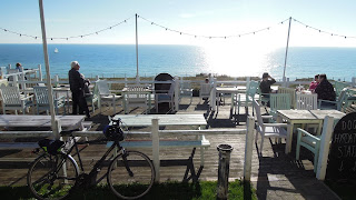
| Smugglers Rest pub overlooking the cliffs |
 |
| Undercliff access road, Saltdean |
 |
| The undercliff road makes a superb cycleway |
 |
| Looking back to the coast |
 |
| Downs behind Rottingdean |
 |
| Cycle path descending beside the Falmer Road |

Comments
Post a Comment