 [For a ride along the Thames to the West, between Cliffe and Gravesend, see this blog.]
[For a ride along the Thames and Swale to the South-East, between Gillingham and Graveney see this blog]
[For a ride along the Thames to the West, between Cliffe and Gravesend, see this blog.]
[For a ride along the Thames and Swale to the South-East, between Gillingham and Graveney see this blog]
This ride around the Hoo Peninsula in Kent completed another leg in my quest to cycle the shores of Thames Estuary. I have done
Gravesend to Dartford to the West, and the
Isle of Sheppey and
Graveney to Gillingham to the East. Here is a map of our ride. Hoo has a fascinating history (and geography), with a ruined Victorian fort (at Cliffe), the remnants of an explosives factory, associations with Charles Dickens, nature reserves and (on the Isle of Grain) important industrial activity. Our track this day is shown in blue, but for completeness I have also added a couple of short rides I did a while ago in red.
On a lovely July day, we started by grabbing a brunch at the Cliffe Cafe before parking in the village car park next to the Church in Cliffe, and headed West through the RSPB Cliffe Pools reserve to reach the headland on the Northern bank of Cliffe Creek. Then we followed the coastal path all the way round to All Hallows, a distance of about 14 miles. Initially there was a good track below the sea wall, which then became a path along the top of the embankment. (As for all similar rides described on my blog, these paths provided a firm if rough surface after a good hot dry spell: after rain and in winter it is probably a different story.) Views across the river were dominated by the cranes of the new London Gateway Port. Views inland across the flat grassland reveal numerous low, roofless ruined buildings on a grid pattern. These are the remains of the Cliffe explosives factory which once operated here, closing in 1921.
 |
| The Cliffe Cafe at Buckland Lake: does a good breakfast |
 |
| Car park in Cliffe |
 |
| Path in RSPB Cliffe Reserve |
 |
| Looking across Cliffe Creek to aggregate works and location of Cliffe Fort |
 |
| Obelisk marking the limit of the authority of the Thames Watermen |
 |
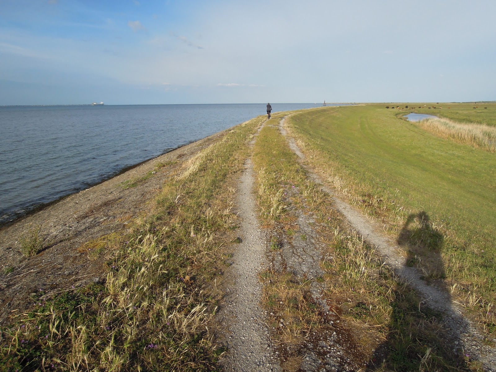
| Typical track |
 |
| View across Thames to the cranes of London Gateway Port |
There were several gates and fences with stiles where it was necessary to lift our bikes over, which did get quite tiresome after a while. We were surprised to encounter a substantial new 'lagoon' not shown on the Ordnance Survey maps: this is the new Salt Flats Nature Reserve, an environmental offset funded by the London Gateway developers, created by breaching the old sea wall and constructing a new retaining embankment inland. We then passed around Egypt Bay and St Mary's Bay, the view across the Thames to the cranes of London Gateway giving way to the oil storage tanks and beach huts of Canvey Island, with Hadleigh Castle just visible behind on the ridge line (see
previous blogpost for a circumnavigation of Canvey Island by bike, including a visit to said castle). Arriving thus at Coombe Point Beach, we discovered the path from here to All Hallows is only vaguely defined, passing through marshy ground behind the shoreline. Instead, we took to the 'beach'. This was sand, shingle and mud: too soft to cycle on so we pushed the final mile or so to arrive with some relief in the Holiday Park. Fortunately it was low tide: this beach is probably covered at high tide.
 |
| Ruined roofless buildings from the old explosives factory |
 |
| London Gateway |
 |
| Nice flowers (Canvey Island/Southend in the background) |
 |
| The new Salt Fleet Flats reserve, created by breaching the old sea wall |
 |
| From the eastern side of Salt Flats |
 |
| Typical trackway |
 |
| The beach in Egypt Bay |
 |
| Egpyt Bay |
 |
| Looking across to Southend |
 |
| The Thanes is busy with shipping |
 |
| There are several nice beaches along the way |
 |
| There are several gates and styles to cross |
 |
| Coombe Point Beach |
 |
| It's a long slog along the beach to All Hallows Holiday Village (and a swim at high tide) |
 |
| Marooned pill box |
 |
| All Hallows Holiday Park |
After buying refreshments in the Londis minimarket in All Hallows village, we returned via roads to our start point in Cliffe, crossing surprisingly high ground after the dead flat ground we had passed through. We stopped off in the churchyard in the village of Cooling. Here, there is a pathetic set of graves: one 'adult' gravestone and thirteen lozenge shaped stones being the graves of thirteen babies
who died between 1767 and 1854 representing several generations of one family: they possibly died from 'marsh fever' ie malaria. The churchyard is believed to have inspired the opening chapter of Charles Dickens' novel Great Expectations (1860). Dickens' home, Gadshill, was nearby in Higham, and he used to picnic with his family in the Cooling churchyard. Pip talks of '....five little stone lozenges, each about a foot and a half long, which were arranged in a neat row beside [my parents'] grave, and were sacred to the memory of five little brothers of mine.....' Here also perhaps Pip encountered Magwich. One can imagine how mist would descend and a convict escaped from the prison ships on the Thames might hide behind a gravestone here.
 |
| View to Isle of Grain from the high road out of All Hallows |
 |
| The grave in the 'Great Expectations' churchyard at Cooling |
 |
| Cooling Castle (said to be the home of Jools Holland, the barn is a 'venue' for weddings etc) |
We finally arrived back at Cliffe at around 6.30pm, having ridden a total of about 24 miles, and indulged in a meal at the Six Bells Inn before setting off home.
I also show in red a ride continuing East from All Hallows out to Yantlet Creek, where a stone obelisk - a 'London Stone' - on the foreshore, with its twin - the Crow Stone - on the northern shore near Southend, marks the downstream limit of the jurisdiction of the Port of London Authority.
 |
| Path East from All Hallows |
 |
| Approaching the Yantlet Creek (storage tanks on Isle of Grain in the background) |
The Yantlet Creek is the inlet which once divided the Isle of Grain from the rest of the Hoo Peninsula. The Isle is now home to a strategically important Liquefied Natural Gas import facility as well as a power station and a container terminal. The shore in front of these facilities has been designated the Grain Coastal Park and as shown in red, the sea wall provides a short but interesting cycle ride, with views across to Sheerness on Sheppey.
 |
| Grain Coastal Park |
 |
| Coastal path (Sheerness in distance) |
 |
| End of the path |
 |
| Grain power Station (look closely and you will see that there is a Little Owl on top of the concrete building in the foreground) |
The area between the Yantlet and the town of Grain is a military range, and has no public access so far as I know.


Comments
Post a Comment