All sections Next: Avebury>Ogbourne Previous: Old Sarum>Stonehenge
For an alternative ride between Stonehenge and Avebury, based on NCN45 and alternative tracks across and around the military range, see this previous blog.
For my attempt to ride the Wansdyke, see this previous blog.
In my last ride along the KAW, I reached Stonehenge. Today, I completed the next section to the standing stones at Avebury, map below. (Forgive and ignore a few obvious overshoots - it's really very easy to follow with the official Cycling UK GPX file. Note also that the official Cycling UK route skirts round the military live firing danger areas, so you are fine to continue even if the red flags are flying, but you must be absolutely sure you are following the official route.)
This section of the KAW is tough but very satisfying. It links two ancient sites, and crosses the Wansdyke and the Kennet and Avon Canal. It traverses expansive open countryside - Salisbury Plain and (less well known, and a revelation) the Tan Hill downs - with far reaching views all around.
 | | From Stonehenge..... |
|
 | | ... to Avebury |
|
I started at 0930 from the car park at the Stonehenge Visitor Centre - free parking for the day for members of English Heritage and National Trust. Being pedantic about following the KAW route, I cycled down to the stone circle and picked up the route there. The section along The Packway is rather tedious: the official route takes a byway next to the road, which was a bit overgrown, and I just stayed on the road: it is quite busy, but it doesn't take long before you branch off towards Rollestone Camp and the Great Bustard Tea Rooms (check infrequent opening times), and say goodbye to traffic until you cross the Vale of Pewsey from Chirton (which was quite quiet anyway).
There are two excellent tarmacked but virtually traffic free roads: the first, from Gore Cross ascending to the military range perimeter road above West Lavington, the second from Allington, rising to the 'pass' through the Tan Hill ridge. The inevitable descents (to Chirton and Beckhampton respectively) include some narrow single track sections which need care.
I finished at about 1600 at the tea room in Avebury (mercifully, just a few minutes before it closed), having taken some time for photo stops and an alfresco picnic, and having done about 34 miles. It was a hot day and I was tuckered out and indulged myself with a taxi ride back to the start from Norman of Aldbourne Taxis, who is very happy to carry bikes and their riders on the Western half of the KAW, as well as transfer luggage for those staying overnight.
 |
| Car park at Stonehenge Visitor Centre (free to EH and NT members) |
|
| Needs no caption |
 |
| Hippy central |
Road near Rollestone Camp (route stays outside danger zone)
 |
| Path to Orcheston |
 |
| Orcheston church |
 |
| Route climbs out of Orcheston |
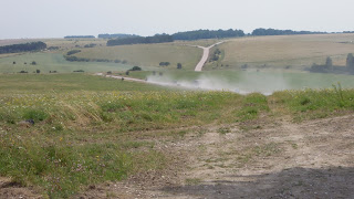 |
| Military convoy on ranges nr Tilshead |
 |
| Shady section nr Tilshead |
 |
| Tilshead water tower |
 |
| Fellow KAWayfarers |
 |
| Twixt Tilshead and Gore Cross |
 |
| Keep to the official KAW route and you skirt live firing zones |
 |
| Great road rising from Gore Cross |
 |
| Fine views open up |
 |
| The military range perimeter track |
 |
| Views to Alton Barnes White Horse (you cross these hills later) |
 |
| Hay bale picnic |
 |
| Descent from perimeter track is narrow single track and needs care |
 |
| Flatter country in the Vale of Pewsey |
 |
| Cross K&A Canal |
 |
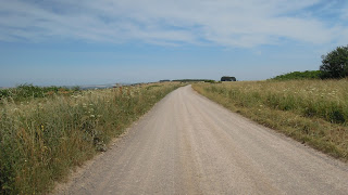
| Another fantastic traffic free road over Tan Hill (but it's a beast to climb on a hot day!) |
 |
| Approaching the Tan Hill pass |
 |
Tan Hill
|
 |
| On the descent you cross the Wansdyke ditch. Morgan's Hill, on the horizon with two radio towers, is part of the Civil War battlefield of Roundway Down, 1642 |
 |
| Lovely descent |
 |
Views across to Morgan's Hill (with radio towers, left) and Cherhill (with monument, right).
|
 |
| You leave the lovely road and descend to Beckhampton on single track, take care! |
|
| Avebury standing stones |


Comments
Post a Comment