Previous section: Earlsfield to Richmond
Next section: Horsenden hill to Hackney Wick
The Capital Ring is a long distance walking route circumnavigating the inner suburbs of London. Think of it as a green equivalent of the North and South Circular Roads (There is also a London Loop, a walker's equivalent of the M25.)
The route is well documented in a series of PDFs available for download on the Tfl website. Although a walker's route, much of it seems to be on back roads or cycle friendly paths, so I intend to see how feasible it is as a cycling route. I would also like to make use of the current dry spell when the paths should provide good going, free from the mud which will doubtless return when our usual rainy summer weather returns.
The most accessible part of the route for me is around Richmond-upon-Thames (I have covered part of the route already - see this blogpost). I parked at the riverside car park at Ham, joined the route at Richmond Bridge and followed it as far as Horsenden Hill, then I just retraced the route back to the start, but with a couple of variations shown in red on the map. I found it an interesting and enjoyable ride, including Thames riverside, Syon Park, Grand Union Canal, Brent Valley and Horsenden Hill, which is a good viewpoint over to North London. All the paths were open to cycling as far as I could tell, and in good condition, though as aforementioned, I think the off-road elements, especially in the Brent Valley, might be muddy after rain.
Map and photos follow: my gps track is in blue. I have included all the sections I have completed.
 |
| Ham House (actually this is slightly off the CR route) |
 |
| I joined the CR at Richmond |
 |
| Riverside buildings, Richmond: despite their Georgian appearance, these are a modern development, in keeping with the town's existing vernacular |
 |
| Cross from the South to the North bank of the Thames at Richmond Lock |
 |
| Isleworth |
 |
| Syon House |
 |
| Road leaving Syon Park |
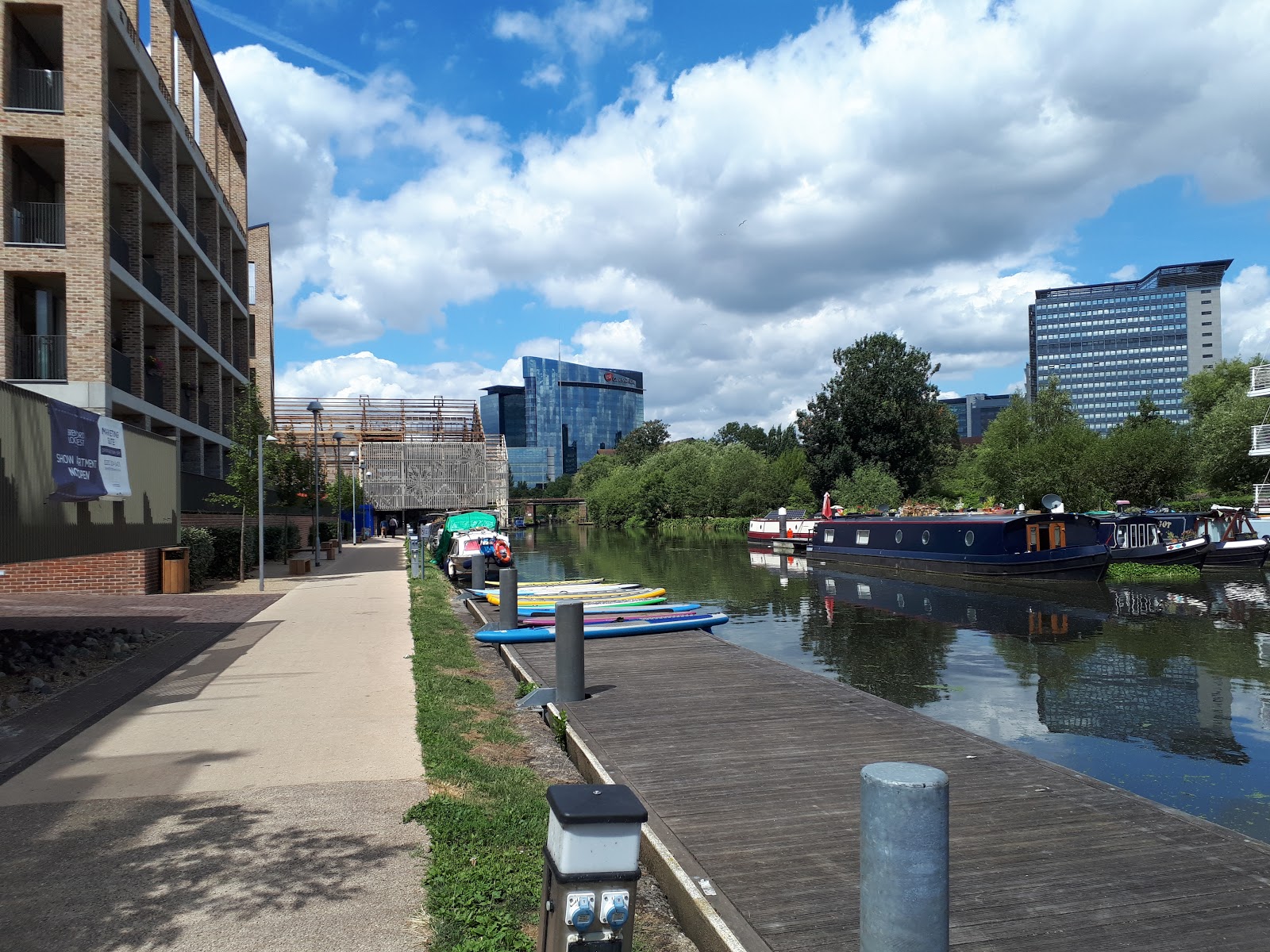 |
| Grand Union Canal, Brentford |
 |
| The Capital Ring is reasonably well signed, although I did get lost at a couple of points, so it's worth programming the route into a GPS if you have one |
 |
| Grand Union towpath |
 |
| The path leaves the Grand Union at Hanwell Lock Flight and follows the sleepy River Brent |
 |
| The route goes under the Wharncliffe Railway Viaduct, built 1836-7 by I K Brunel to carry the GWR from Paddington |
 |
| One route option follows this good tarmac path across Churchfields (easier than the alternative across grass beside the River Brent) |
 |
| Friendly horse at Hanwell Church |
 |
| Bridge across Brent |
 |
| Typical path through the Brent Valley Park: compacted grit, good for cycling |
 |
| Perivale Park |
 |
| Wildflower bed in Perivale Park |
 |
| Cross the A40 on this footbridge |
 |
| Grand Union Canal, Greenford (turned green with pondweed in this current heat wave) |
 |
| GUC towpath towards Horsenden |
 |
| Garden at Horsenden Hill Visitor Centre |
 |
| Rather than use the official Capital Ring path up Horsenden Hill, I followed this pavement next to the road.... |
 |
| .... and then pushed up this path to the top of Horsenden Hill |
 |
| There are good views South West towards Heathrow and the North Downs |
 |
| ......and also North towards Harrow on the Hill |
 |
| Horsenden Hill summit trig point |
 |
| Wembley Stadium arch can be glimpsed through the gaps in the trees |
 |
| Flood tide on the Thames towpath on my return journey |
Comments
Post a Comment